


Offered by:
Timeless Intaglio – Rare Prints, Maps & Books
By Appt.
Alamo, CA 94507 , United States
Call Seller
925.272.8170
Showrooms
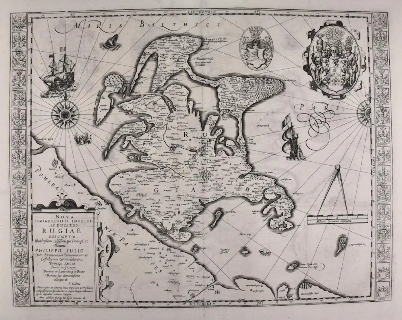
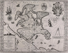
Rugen Island, Germany: An Early 17th Century Map by Mercator and Hondius
-
Description
This is an early 17th century map entitled "Nova Famigerabilis Insulae Ac Ducatus Rugiae Desciptio" (Map of Rugen Island, Germany) by Gerard Mercator and Henricus and Joducus Hondius, published in Amsterdam in 1623 in 'Atlas sive cosmographicae meditationes de fabrica mundi et Fabricati Figura' (Atlas or cosmographical meditations on the structure of the world and the Fabricated Figure), which was the first time the word" atlas" was used to describe a collection of maps published in book form. His engraved title-page showed King Atlas measuring the world with a pair of calipers. King Atlas was a mythical ruler of Mauritania, a mathematician and philosopher who supposedly made the first celestial globe. The term atlas has become the standard not only for a collection of maps, but also anatomical prints and other genres.
map of Rügen with Hiddensee by Eilhard Lübben. Shows the coast of the Baltic Sea from Peenemunde and Stralsund to Barhöft and the island of Rügen with many details. The coastline of Rügen largely corresponds to today's characteristics. The map is decorated with two galleons, several sea monsters, two large compass roses, one mileage scale with dividers and a cartouche with a large coat of arms. The left and right sides are flanked with 15 small coat of arms each. From the Mercator-Hondius Atlas published in 1623. Latin text on verso.
This map is focussed on Rügen Island (Latin: Rugia, Ruegen), Germany's largest island. It is located in the Baltic Sea, off the Pomeranian coast of northern Germany and is part of the state of Mecklenburg-Western Pomerania. In the Middle Ages it was ruled by Denmark. It later became a Duchy and then Province of Pomerania and in the 19th century, part of Germany.
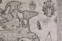
This detailed and quite decorative map contains two striking compass roses, two detailed sailing ships, three sea monsters, a bird, as well as a massive coat-of-arms and a smaller one in the upper map on the right. There are thirty smaller coat-of-arms along both side borders (fifteen along each side border), representing the island's leading families. There is jagged line to the right of the title cartouche in the right lower corner that resulted from a crack in the copper plate, which presumably occurred shortly after production of the plate, or even before, as it seen on virtually all surviving examples of the map.
This highly detailed and striking map is printed on thick, laid, chain-linked paper with wide margins. The sheet measures 18.38" wide and 21.75" high. There is Latin text on the verso. The map has a central fold, as issued. There is faint discoloration and an occasional small spot in the margins and a small chip at the lower edge of the sheet. There is some offset of outlines from the opposite side of the map resulting from having been folded in an atlas for almost 400 years. The map is otherwise in excellent condition.
Gerard Mercator (1512-1594) is one of the greatest cartographers of all time. His friend, Abraham Ortelius, referred to Mercator as being the “contemporary Ptolemy”. He was born in Flanders and moved to Duisburg in the Netherlands, where he lived and worked for the rest of his life. In addition to producing important maps and globes, he invented a projection on maps that presented all parallels and meridians at right angles to each other, with the distance between the parallels extending towards the poles, allowing accurate latitude and longitude calculation and navigational routes to be drawn using straight lines. This was an important technological advance for navigation at sea, as this allowed seafarers to plot their course without having to adjust their course based on frequent compass readings. These lines became known as Mercator's projections when used by subsequent cartographers, including current map makers. As mentioned above, he is also the first to use the term “atlas”, to describe a collection of maps published in one bound book.
Jodocus Hondius (1563-1612) was a prominent globe maker and map engraver from Ghent (Flanders). After spending some time in London, he established his business in Amsterdam in 1593. Hondius bought the plates of Gerard Mercator in 1604 and added around 40 of his own maps in an atlas that he first published in 1606, preserving Mercator's name. After his death in 1612 in Amsterdam, the business was continued by his sons Jodocus II and Henricus. -
More Information
Documentation: Signed Period: Pre 18th Century Condition: Good. Styles / Movements: Traditional Incollect Reference #: 608702 -
Dimensions
W. 21.75 in; H. 18.38 in; W. 55.25 cm; H. 46.69 cm;
Message from Seller:
Timeless Intaglio is an online gallery of rare and collectable antiquarian prints, maps and books. Although we specialize in all forms of vintage printed works on paper, the majority were created with the intaglio method of transferring ink from a plate, usually copper, to paper with a technique utilizing pressure generated by a press. Email us directly: rbreiman@timelessintaglio.com
More Listings from Timeless Intaglio – Rare Prints, Maps & Books View all 637 listings
-
Tortoise-shell Butterfly, Hawk Moth: Antique Hand-colored Engraving by M. Harris

-
Natural History of Moths and a Beetle: A Hand-colored Engraving by Moses Harris

-
Butterflies & Moths: A 1st Ed. Hand-colored 18th C. Engraving by M. Harris

-
Asparagus: An 18th Century Hand-colored Botanical Engraving by J. Weinmann

-
Horned Grebe: An Original 19th C. Audubon Hand-colored Bird Lithograph

-
Peacock Butterfly & Moth: A 1st Ed. Hand-colored 18th C. Engraving by M. Harris

-
American Coot: An Original 19th C. Audubon Hand-colored Bird Lithograph

-
American Avocet: An 19th Century Audubon Hand-colored Bird Lithograph

-
Admirable Butterflies, Magpie Moths: A Hand-colored Engraving by Moses Harris

-
The Natural History of Moths: An Antique Hand-colored Engraving by Moses Harris

-
Butterflies & Moths: An Antique Hand-colored Engraving by Moses Harris

-
Cotton Plant: An 18th Century Hand-colored Botanical Engraving by J. Weinmann

-
Apple: An 18th Century Hand-colored Botanical Engraving by J. Weinmann

-
Yellow-breasted Rail: An Original 19th C. Audubon Hand-colored Bird Lithograph

