
Offered by:
The Great Republic
1 Lake Circle
Colorado Springs, CO 80906 , United States
Call Seller
719.471.6157
Showrooms
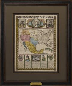
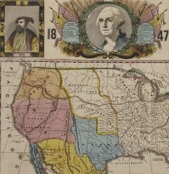
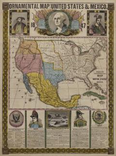
1847 "Ornamental Map of the United States & Mexico" by H. Phelps, Hand-Colored
-
Description
Offered is an original 1847 ornamental map of the U.S. entitled "Ornamental Map of the United States & Mexico" by Humphrey Phelps. The map was issued as an act of Congress by Phelps on Fulton Street, New York. The broadside is elaborately hand-colored.
This is a very detailed and graphic propaganda map of the United States expressing U.S. dominance of the North American continent. The hand-colored map is a cartographic embodiment of Manifest Destiny, with the recent acquisition of Upper California, New Mexico, and Texas at the conclusion of the Mexican-American War. The newly acquired land is boldly colored, standing in stark contrast to the rest of the U.S. The map details a potential route for a railroad running from New York City, to Buffalo, to Chicago, then west along the Oregon Trail to Oregon City. This route anticipates the construction of the transcontinental railroad by nearly 20 years.
The map includes elaborately detailed renderings of George Washington, Hernan Cortez, and Montezuma at top to represent European expansion to the Americas. At bottom are four inset designs with text showing the following: a chronological history of the U.S. beginning from settlement to the U.S. victory in the Mexican-American war; an illustration of General Zachary Taylor with details on the Oregon Territory; an illustration of the Aztec Temple of the Sun in Tenochtitlan and a chronology of the Conquest of the Aztec Empire under Cortez; a portrait of General Antonio Lopez de Santa Anna with a description of the newly acquired New Mexico and California territories; and an illustration detailing “The Republic of the United States of Mexico” with a description of the accomplishments of the Aztec people with a history of the conquest of Mexico and statistics of silver mines.
This is the second edition of the map, the first having been issued one year earlier in 1846. The changes between the editions were minor, besides the addition of tables describing the population of Mexico by state and the distances in Mexico.
CONDITION:
Overall good condition for age. Bright hand-coloring intact, minor fold lines and wear along margins. Framed according to conservation standards. -
More Information
Documentation: Documented elsewhere (exact item) Notes: Printed at bottom Origin: United States Period: 19th Century Materials: Hand-colored engraved broadside Condition: Good. Bright hand-coloring intact, minor fold lines and wear along margins. Creation Date: 1847 Styles / Movements: Other , Color Dealer Reference #: M197 Incollect Reference #: 700927 -
Dimensions
W. 37 in; H. 44.5 in; D. 1.25 in; W. 93.98 cm; H. 113.03 cm; D. 3.18 cm;
More Listings from The Great Republic View all 38 listings
-
Vintage Union Jack, Circa 1950s

-
"Legends of the West - Indian Chief" by Chris Calle, Mixed Media Painting

-
34-Star Civil War Kansas Flag Great Star “Flower” Pattern, Circa 1861

-
Civil War-Era Side Drum, Made by George Kilbourn, 1859

-
"Colorado" Vintage United Airlines Travel Poster by Joseph Feher, 1950s

-
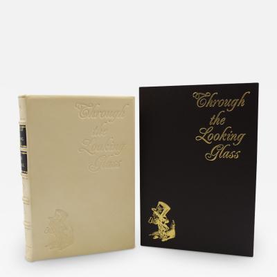
Through the Looking-Glass and What Alice Found There, Lewis Carroll, 1st US Ed.
-
George Washington Signature Collage

-
"Fort Worth" Vintage Delta Airlines Travel Poster by John Hardy, circa 1950s

-
1859 "Map of the United States of America, British Provinces, Mexico" by Colton

-
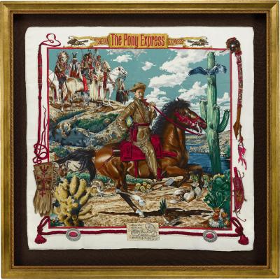
Vintage "The Pony Express" Hermès Scarf by Kermit Oliver
-
The White House Cookbook by F. L. Gillette, Later Printing, 1894

-
From Russia, With Love by Ian Fleming, First Edition, 1957

-
The Catcher in the Rye by J.D. Salinger, First Edition, in Dust Jacket, 1951

-
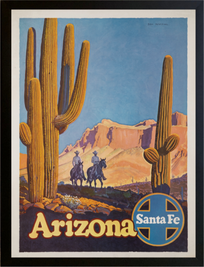
"Arizona" Vintage Santa Fe Railroad Travel Poster by Don Perceval, circa 1940s