


Offered by:
Arader Galleries
1016 Madison Avenue
New York City, NY 10075 , United States
Call Seller
215.735.8811
Showrooms
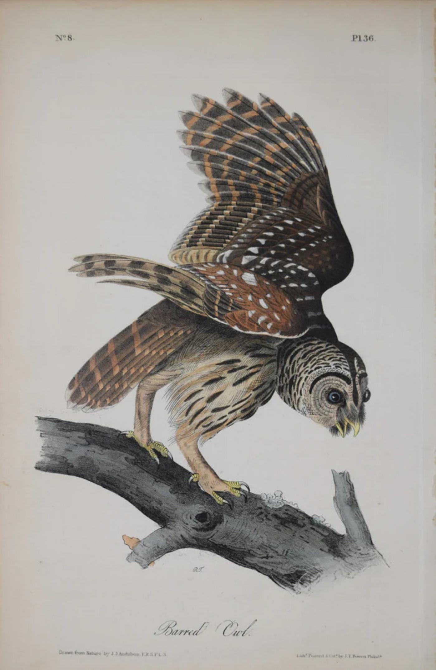
JOHN JAMES AUDUBON (AMERICAN, 1785-1851), PL 36 - BARRED OWL
-
Description
John James Audubon (American, 1785-1851)
Pl 36 - Barred Owl
from the first octavo edition of Birds of America
New York and Philadelphia: J.J. Audubon and J.B. Chevalier, 1839-44
Lithograph with original hand color
Paper size: approx. 10 1/4 x 6 1/2" -
More Information
Documentation: Documented elsewhere (similar item) Period: 18th Century Condition: Good. Styles / Movements: Other Incollect Reference #: 678092 -
Dimensions
W. 6.5 in; H. 10.25 in; W. 16.51 cm; H. 26.04 cm;
Message from Seller:
Founded in 1971, Arader Galleries is the leading dealer of rare maps, prints, books, and watercolors from the 16th to 19th centuries. Visit us at 1016 Madison Avenue, NYC, or contact us at 215.735.8811 | loricohen@aradergalleries.com |
More Listings from Arader Galleries View all 1352 listings
-
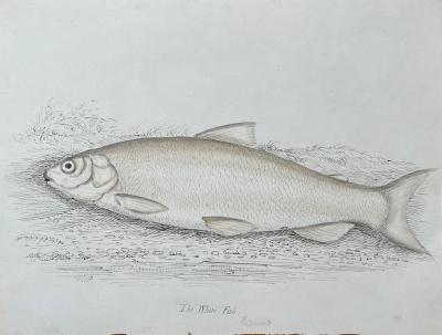
WILLIAM POPE (BRITISH/CANADIAN, 1811-1902), THE WHITE FISH REDUCED
-
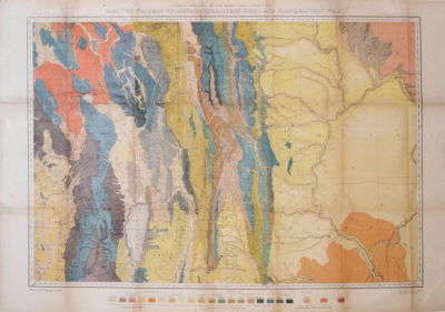
F.V. HAYDEN, PARTS OF WESTERN WYOMING, SOUTHEASTERN IDAHO AND NORTHEASTERN UTAH
-
DUTCH SCHOOL (17TH CENTURY)

-
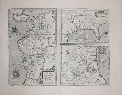
PERUVIAE AURIFERAE REGIONIS TYPUS
-
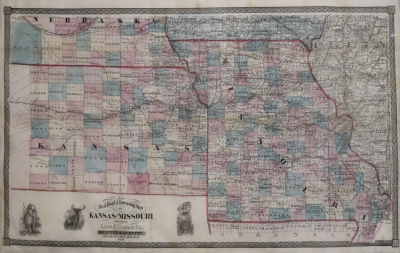
GEORGE F. CRAM (1842-1928), NEW RAILROAD & TOWNSHIP MAP OF KANSAS AND MISSOURI
-
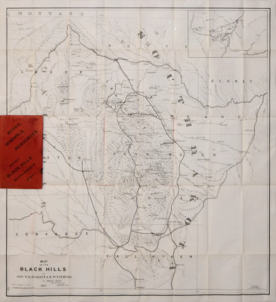
SAMUEL SCOTT, MAP OF BLACK HILLS OF SOUTH DAKOTA AND WYOMING
-
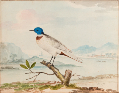
A BLUE HEADED TERN IN AN ESTUARY LANDSCAPE
-
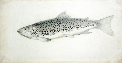
SIR WILLIAM JARDINE (SCOTTISH, 1800-1874) THE BRITISH SALMONIDAE
-
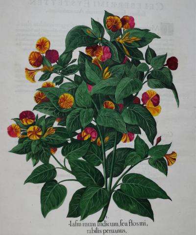
BASILIUS BESLER (1561-1629), IAFMINUM INDICUM, FEU FLOSMI, RABILIS PERUANUS
-
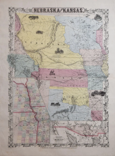
J.H. COLTON (1800-1893), NEBRASKA AND KANSAS
-
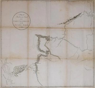
A MAP OF MACKENZIE’S TRACK FROM FORT CHIPEWYAN TO THE PACIFIC OCEAN IN 17
-
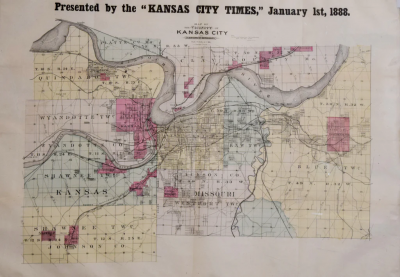
MAP OF THE VICINITY OF KANSAS CITY...PRESENTED BY THE KANSAS CITY TIMES
-
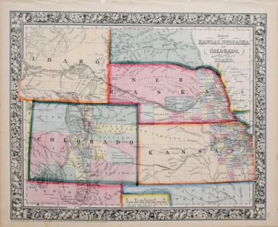
SAMUEL AUGUSTUS MITCHELL (1790-1868), MAP OF KANSAS, NEBRASKA AND COLORADO
-
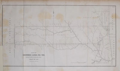
PLAT OF CHEROKEE LANDS, IND. TER: SURVEYED UNDER INSTRUCTIONS FROM ISAAC MCCOY