


Offered by:
The Great Republic
1 Lake Circle
Colorado Springs, CO 80906 , United States
Call Seller
719.471.6157
Showrooms
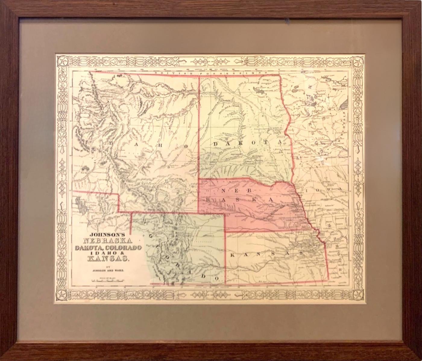
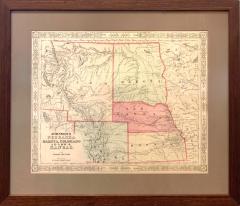
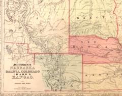
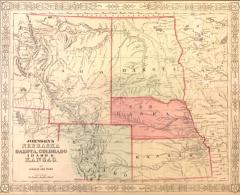
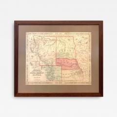
1865 "Johnson's Nebraska, Dakota, Colorado, Idaho & Kansas" Map, Johnson & Ward
-
Description
Presented is an original 1865 "Johnson's Nebraska, Dakota, Colorado, Idaho & Kansas” map. This map was issued as page 63 in the 1865 edition of “Johnson's New Illustrated (Steel Plate) Family Atlas.” The map is engraved, with attractive hand coloring and a decorative strapwork border. The state of Kansas and territories of Idaho, Dakota, Nebraska, and Colorado are outlined in pink and colored by county. Depicted but not colored are the neighboring states of Minnesota and Missouri. The map is beautifully detailed, with mountain ranges, rivers, and creeks all marked. Some roads and a few towns and forts are marked on the map. Several Native American tribes are labeled throughout the area, including the Osages, Arapahoes, Cheyennes, Dakotahs, Blackfeet, and more. There is a “Proposed route of the Pacific R.R.” marked on the map.
This 1865 Johnson and Ward publication of “Johnson's New Illustrated (Steel Plate) Family Atlas” was written by Richard Swainson Fisher, M.D. Fisher was also the author of "Colton's General Atlas of the World," "The Gazetteer of the United States," and a past editor of the Journal of American Geographical and Statistical Society. The publishing company of Johnson and Ward was a successor to Johnson and Browning, themselves a successor to the famous publishing company, J. H. Colton and Company. A combination of both new plates and older, updated ones, all of the maps in this atlas were compiled, drawn, and engraved under the supervision of J. H. Colton and A. J. Johnson. The new plates, copyrighted by A.J. Johnson, were made exclusively for Johnson's New Illustrated Family Atlas. Others are the same as used in "Colton's General Atlas."
This early 1865 issued atlas offered a really unique and timely snapshot of the United States just after the Civil War. In addition to the maps, the atlas had several pages of American history, recent federal census data, and geographical and statistical notes. The highlight was its “Chronological History of the Civil War in America” with battle records and dates. It also contained updates on the assassination of Abraham Lincoln and subsequent pursuit and death of John Wilkes Booth and included two Civil War-era maps, one of the “Vicinity of Richmond and Peninsular Campaign in Virginia” and the “New Military Map of the United States.”
CONDITION: Fine condition overall. Hand Colored. Plate 63 from Johnson's New Illustrated (Steel Plate) Family Atlas. Strapwork border. Colored in the state of Kansas and territories of Idaho, Dakota, Nebraska, Kansas, and Colorado. Uncolored in neighboring states of Minnesota and Missouri. Toning, few areas of foxing. Loss to bottom left corner. Archivally framed with acid-free mats, UV Conservation Clear glass, and a custom built wooden frame. -
More Information
Origin: United States Period: 19th Century Materials: paper Condition: Good. Toning, few areas of foxing. Loss to bottom left corner. Creation Date: 1865 Styles / Movements: Americana, Traditional Dealer Reference #: M355 Incollect Reference #: 709803 -
Dimensions
W. 21.375 in; H. 18.5 in; D. 0.75 in; W. 54.29 cm; H. 46.99 cm; D. 1.91 cm;
More Listings from The Great Republic View all 37 listings
-
"Come to Britain for Golf" Vintage Travel Poster, Circa 1952

-
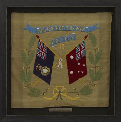
Souvenir of the War 1914-15-16-17-18 Banner
-
The Catcher in the Rye by J.D. Salinger, First Edition, in Dust Jacket, 1951

-
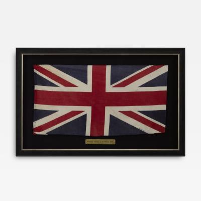
Vintage Union Jack, Circa 1950s
-
Civil War-Era Side Drum, Made by George Kilbourn, 1859

-
34-Star Civil War Kansas Flag Great Star “Flower” Pattern, Circa 1861

-
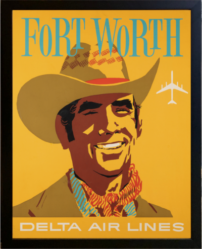
"Fort Worth" Vintage Delta Airlines Travel Poster by John Hardy, circa 1950s
-
The White House Cookbook by F. L. Gillette, Later Printing, 1894

-
From Russia, With Love by Ian Fleming, First Edition, 1957

-
1859 "Map of the United States of America, British Provinces, Mexico" by Colton

-
"Legends of the West - Indian Chief" by Chris Calle, Mixed Media Painting

-
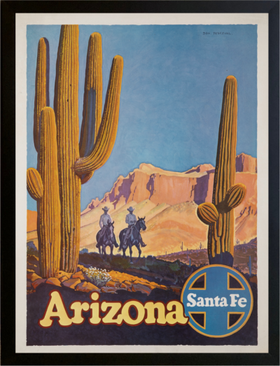
"Arizona" Vintage Santa Fe Railroad Travel Poster by Don Perceval, circa 1940s
-
George Washington Signature Collage

-
"Colorado" Vintage United Airlines Travel Poster by Joseph Feher, 1950s

