


Offered by:
Timeless Intaglio – Rare Prints, Maps & Books
By Appt.
Alamo, CA 94507 , United States
Call Seller
925.272.8170
Showrooms
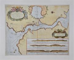
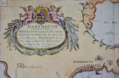
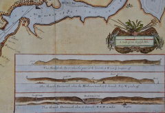
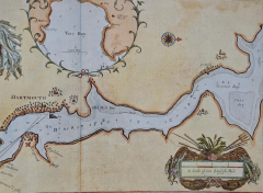
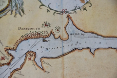
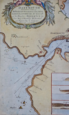
Dartmouth, England: A Hand-Colored 17th Century Sea Chart by Captain Collins
-
Description
This hand-colored sea chart of the area around Dartmouth, England is from "Great Britain's Coasting Pilot. Being a New and Exact Survey of the Sea-Coast of England", first published in 1693. It depicts the city of Dartmouth, England and its surrounding waterways. Three insets in the lower chart demonstrate the topographic elevations of the coastline.
These sea charts by Captain Greenvile Collins (1643-1694) are beautiful, colorful and striking, as well as historically very important to the British navy for approximately 100 years. Captain Collins was appointed “His Majesty’s Hydrographer” by King Charles II and asked to survey the coast of Great Britain and plot all of the harbors, rivers and islands, etc. This took seven years and the resulting charts were first published in 1693. They were published until 1792.
We have 16 sea charts from this series that are all the same size and are framed and matted identically. The frames are a unique plexiglass sleeve design, measuring 27.75" x 23' x 0.5" and the mats are a cream color. There is a central fold, as issued and a tiny spot in the right lower corner. The chart is otherwise in excellent condition.
The provenance for these sea charts is very interesting. They were owned by Tom Perkins, who is considered one of the fathers of Silicon Valley. He was one of the founders of Kleiner Perkins Cauffield and Byers, the first big and most influential Silicon Valley venture capital company. Perkins himself was an avid sailor and had at the time the largest and most technologically advanced sailing yacht in the world, the Maltese Falcon. I have 16 of his sea charts that are all the same size and are framed and matted identically. The frames are a unique plexiglass sleeve design. -
More Information
Origin: England Period: Pre 18th Century Materials: Paper, Engraved Condition: Good. Wear consistent with age and use. Styles / Movements: Traditional Incollect Reference #: 572665 -
Dimensions
W. 27.75 in; H. 23 in; D. 0.5 in; W. 70.49 cm; H. 58.42 cm; D. 1.27 cm;
Message from Seller:
Timeless Intaglio is an online gallery of rare and collectable antiquarian prints, maps and books. Although we specialize in all forms of vintage printed works on paper, the majority were created with the intaglio method of transferring ink from a plate, usually copper, to paper with a technique utilizing pressure generated by a press. Email us directly: rbreiman@timelessintaglio.com
More Listings from Timeless Intaglio – Rare Prints, Maps & Books View all 640 listings
-
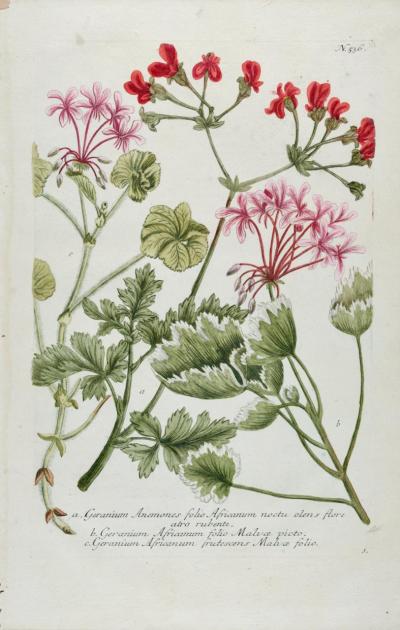
Red Geranium: An 18th Century Hand-colored Botanical Engraving by J. Weinmann
-
American Coot: An Original 19th C. Audubon Hand-colored Bird Lithograph

-
American Avocet: An 19th Century Audubon Hand-colored Bird Lithograph

-
Butterflies & Moths: An Antique Hand-colored Engraving by Moses Harris

-
The Natural History of Moths: An Antique Hand-colored Engraving by Moses Harris

-
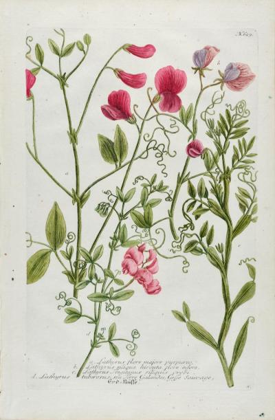
Red Sweet Pea: An 18th Century Hand-colored Botanical Engraving by J. Weinmann
-
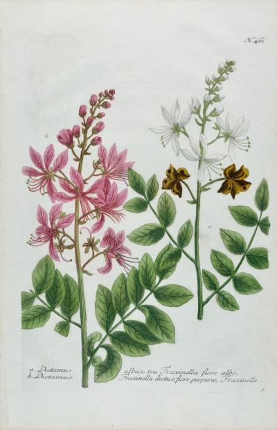
Burning Bush: An 18th Century Hand-colored Botanical Engraving by J. Weinmann
-
Cotton Plant: An 18th Century Hand-colored Botanical Engraving by J. Weinmann

-
Asparagus: An 18th Century Hand-colored Botanical Engraving by J. Weinmann

-
Tortoise-shell Butterfly, Hawk Moth: Antique Hand-colored Engraving by M. Harris

-
Natural History of Moths and a Beetle: A Hand-colored Engraving by Moses Harris

-
Butterflies & Moths: A 1st Ed. Hand-colored 18th C. Engraving by M. Harris

-
Admirable Butterflies, Magpie Moths: A Hand-colored Engraving by Moses Harris

-
Apple: An 18th Century Hand-colored Botanical Engraving by J. Weinmann

