


Offered by:
Timeless Intaglio – Rare Prints, Maps & Books
By Appt.
Alamo, CA 94507 , United States
Call Seller
925.272.8170
Showrooms
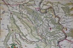
Germany West of the Rhine: A Hand-colored 18th Century Map by de Wit
-
Description
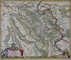
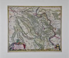
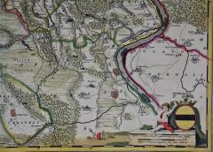
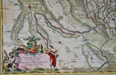
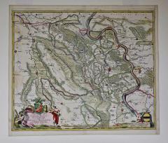
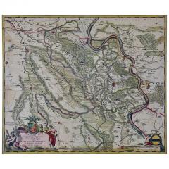
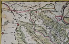
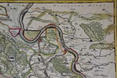
This original 18th century hand-colored map of the county of Moers, Germany entitled "Illustrissimo Celsissmo Principi GUILIELMO HENRICO D.G. Arausionum Principi Domino suo Clementissimo Hanc COMITATUS MEURSENSIS et Annexarum Dinastiarum" by Frederick de Wit was published in Amsterdam by Covens & Mortier in 1721. It depicts Moers, Germany on the west bank of the Rhine River. The colorful title cartouche in the lower left quadrant includes a Coat of Arms along with a Lion and an Eagle at the top and is flanked by a man on the left and a woman on the right.
This attractive mat is presented in a cream-colored mat, measuring 30" wide and 27.5" high. There is slight discoloration in the right upper and lower corners and left lower margin, as well as faint discoloration in the left map periphery. The map is otherwise in excellent condition.
Frederick de Wit (circa 1630-1706) moved to Amsterdam from Gouda in 1646. He learned cartography from the famous Dutch cartographer, Willem Blaeu. De Wit opened his own map and printing business in 1654. His success gradually expanded his business and by the 1670s he was publishing atlases. -
More Information
Origin: Netherlands Period: Pre 18th Century Materials: Paper, Engraved Condition: Good. Wear consistent with age and use. Styles / Movements: Traditional Incollect Reference #: 589636 -
Dimensions
W. 30 in; H. 27.5 in; D. 0.13 in; W. 76.2 cm; H. 69.85 cm; D. 0.33 cm;
Message from Seller:
Timeless Intaglio is an online gallery of rare and collectable antiquarian prints, maps and books. Although we specialize in all forms of vintage printed works on paper, the majority were created with the intaglio method of transferring ink from a plate, usually copper, to paper with a technique utilizing pressure generated by a press. Email us directly: rbreiman@timelessintaglio.com
More Listings from Timeless Intaglio – Rare Prints, Maps & Books View all 640 listings
-
Cotton Plant: An 18th Century Hand-colored Botanical Engraving by J. Weinmann

-
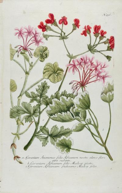
Red Geranium: An 18th Century Hand-colored Botanical Engraving by J. Weinmann
-
American Avocet: An 19th Century Audubon Hand-colored Bird Lithograph

-
Burning Bush: An 18th Century Hand-colored Botanical Engraving by J. Weinmann
-
The Natural History of Moths: An Antique Hand-colored Engraving by Moses Harris

-
Peacock Butterfly & Moth: A 1st Ed. Hand-colored 18th C. Engraving by M. Harris

-
Butterflies & Moths: An Antique Hand-colored Engraving by Moses Harris

-
Asparagus: An 18th Century Hand-colored Botanical Engraving by J. Weinmann

-
Butterflies & Moths: A 1st Ed. Hand-colored 18th C. Engraving by M. Harris

-
American Coot: An Original 19th C. Audubon Hand-colored Bird Lithograph

-
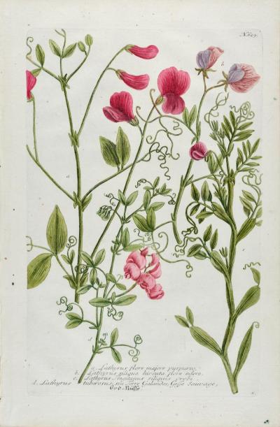
Red Sweet Pea: An 18th Century Hand-colored Botanical Engraving by J. Weinmann
-
Tortoise-shell Butterfly, Hawk Moth: Antique Hand-colored Engraving by M. Harris

-
Admirable Butterflies, Magpie Moths: A Hand-colored Engraving by Moses Harris

-
Apple: An 18th Century Hand-colored Botanical Engraving by J. Weinmann

