


Offered by:
Timeless Intaglio – Rare Prints, Maps & Books
By Appt.
Alamo, CA 94507 , United States
Call Seller
925.272.8170
Showrooms
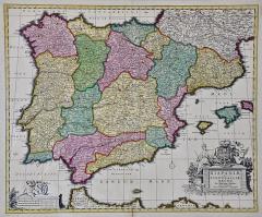
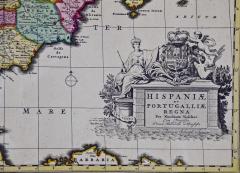
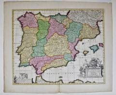
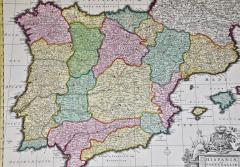
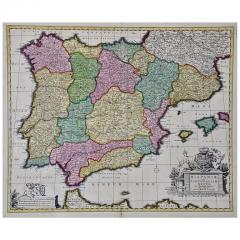
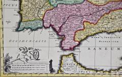
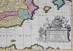
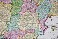
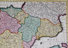
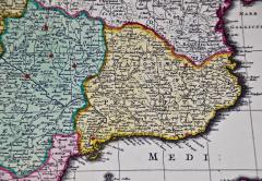
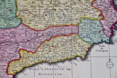
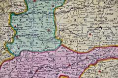
18th Century Hand Colored Map of Spain and Portugal by Visscher
-
Description
This is an early 18th century map of Spain and Portugal, with attractive original hand-coloring, entitled "Hispaniae et Portugalliae Regna per Nicolaum Visscher cum Privilegio Ordinum Hollandiae et Westfrisiae" first published by Nicolaes Visscher II (1649-1702) in 1688, and later re-published from Visscher's original copper plate by Peter Schenk, Junior in Amsterdam in 1725. The cartouche in the right lower corner depicts a coat of arms representing one combined kingdom of Spain and Portugal before their break-up. Putti hold up the coat-of-arms of Phillip II on the right and a queen reaches for it on the left. There is a scale cartouche in the lower left corner surmounted by two putti and a wheel. This is an outstanding depiction of the Iberian peninsula, showing Spain and Portugal and Balearic Islands. The map includes portions of North Africa and the Strait of Gibralter.
This copperplate engraved map is presented in a cream-colored mat. It is printed on fine chain-linked, laid paper. The mat measures 26.5" high by 30" wide and the sheet measures 21.75" high by 26.375" wide. There is a central fold, as issued. The lower portion of the fold is reinforced on the verso. There is a small paper defect at the lower edge of the fold and another at the edge of the right corner, as well as a few small tears along the lower edge; none affecting the map and all covered by the mat. There are a few small faint spots in the upper margin and on the left. The map is otherwise in very good condition.
The Visscher family were one of the great art and cartographic printing families of the 17th century. Begun by Claes Jansz Visscher (1587-1652) in Amsterdam and continued by his son Nicolaes (1618-1679), grandson Nicolaes II (1649-1702) and then by his grandson’s widow, Elizabeth until her death in 1726. Nicolas Visscher I was born 1618 in Wenns, Austria. He died 1679 in Linz. After the death of Nicolas II, his widow passed the business to Pieter Schenk. The Visschers were prolific publishers, producing individual maps and also atlases made up to their customers’ specifications. They are commonly regarded as second only to the Blaeu family, among Dutch mapmakers, for the high quality of engraving and decoration, and the geographical accuracy of their many maps. -
More Information
Documentation: Documented elsewhere (similar item) Origin: Netherlands Period: 18th Century Materials: Paper, Engraved Condition: Good. Wear consistent with age and use. Minor losses. Styles / Movements: Traditional Incollect Reference #: 589635 -
Dimensions
W. 30 in; H. 26.5 in; D. 0.25 in; W. 76.2 cm; H. 67.31 cm; D. 0.64 cm;
Message from Seller:
Timeless Intaglio is an online gallery of rare and collectable antiquarian prints, maps and books. Although we specialize in all forms of vintage printed works on paper, the majority were created with the intaglio method of transferring ink from a plate, usually copper, to paper with a technique utilizing pressure generated by a press. Email us directly: rbreiman@timelessintaglio.com
More Listings from Timeless Intaglio – Rare Prints, Maps & Books View all 640 listings
-
American Coot: An Original 19th C. Audubon Hand-colored Bird Lithograph

-
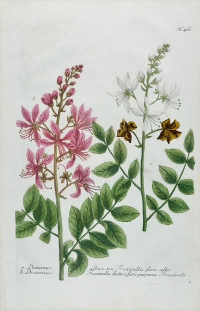
Burning Bush: An 18th Century Hand-colored Botanical Engraving by J. Weinmann
-
Apple: An 18th Century Hand-colored Botanical Engraving by J. Weinmann

-
Butterflies & Moths: A 1st Ed. Hand-colored 18th C. Engraving by M. Harris

-
The Natural History of Moths: An Antique Hand-colored Engraving by Moses Harris

-
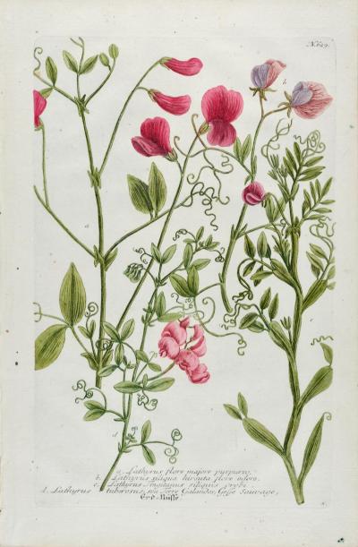
Red Sweet Pea: An 18th Century Hand-colored Botanical Engraving by J. Weinmann
-
Butterflies & Moths: An Antique Hand-colored Engraving by Moses Harris

-
Tortoise-shell Butterfly, Hawk Moth: Antique Hand-colored Engraving by M. Harris

-
Cotton Plant: An 18th Century Hand-colored Botanical Engraving by J. Weinmann

-
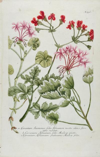
Red Geranium: An 18th Century Hand-colored Botanical Engraving by J. Weinmann
-
American Avocet: An 19th Century Audubon Hand-colored Bird Lithograph

-
Natural History of Moths and a Beetle: A Hand-colored Engraving by Moses Harris

-
Peacock Butterfly & Moth: A 1st Ed. Hand-colored 18th C. Engraving by M. Harris

-
Admirable Butterflies, Magpie Moths: A Hand-colored Engraving by Moses Harris

