


Offered by:
Timeless Intaglio – Rare Prints, Maps & Books
By Appt.
Alamo, CA 94507 , United States
Call Seller
925.272.8170
Showrooms
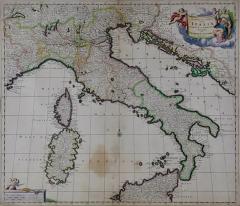
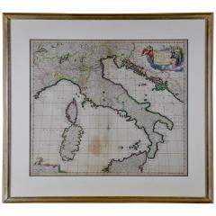
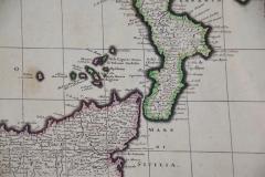
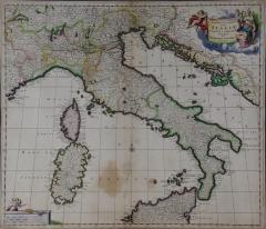
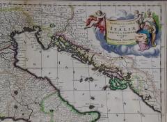
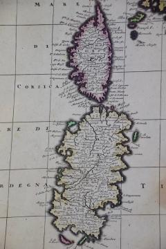
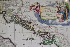
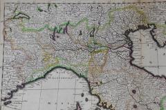
Italy, Sicily, Sardinia, Corsica and Dalmatian Coast: A 17th Century Dutch Map
-
Description
This hand colored 17th century Dutch map entitled "Novissima et Accuratissima totius Italiae Corsicae et Sardiniae Descriptio" by Theodore Danckerts depicts the Italian Peninsula in its entirety. It also includes the Dalmatian coast, which at the time was controlled by the Republic of Venice. The islands of Corsica and Sardinia and part of Sicily are also represented. At the time this map was made, most of Italy was under Spanish control. Following the War of Spanish Succession (1701-1714), Spain would lose many of its territories to the Habsburg Empire of Austria, and then as a result controlled Italy.
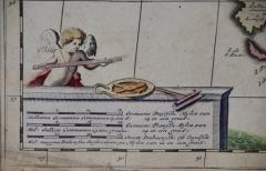
A colorful title cartouche in the top right quadrant depicts two cherubs and an emperor. The scale in the bottom left is also illustrated with a cherub with measuring instruments. Various ships can be seen sailing in the waters as a naval battle rages in the Tyrrhenian Sea.
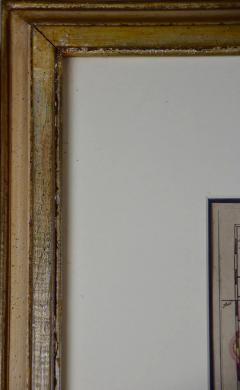
The map is presented in a tan colored wood frame with light gold colored inner and outer trim, with a double mat; the outer mat is cream-color and the inner mat is dark brown. There are focal areas of discoloration in the lower portion of the map, but the map is otherwise in very good condition.
The Danckerts were a prominent 17th and early 18th century Dutch cartographic, engraver and printing family. Cornelis Danckerts I (1603-1656) began the family business in Amsterdam. The skill and the trade was passed to his son, Justus Danckerts (1635-1701 and subsequently to his sons, Theodorus Danckerts I (1663-1727) and Cornelis Danckerts II (1664-1717) -
More Information
Documentation: Documented elsewhere (similar item) Origin: Netherlands Period: Pre 18th Century Materials: Paper, Engraved Condition: Good. Wear consistent with age and use. Styles / Movements: Traditional Incollect Reference #: 589627 -
Dimensions
W. 31.25 in; H. 18.13 in; D. 1.38 in; W. 79.38 cm; H. 46.05 cm; D. 3.51 cm;
Message from Seller:
Timeless Intaglio is an online gallery of rare and collectable antiquarian prints, maps and books. Although we specialize in all forms of vintage printed works on paper, the majority were created with the intaglio method of transferring ink from a plate, usually copper, to paper with a technique utilizing pressure generated by a press. Email us directly: rbreiman@timelessintaglio.com
More Listings from Timeless Intaglio – Rare Prints, Maps & Books View all 640 listings
-
Tortoise-shell Butterfly, Hawk Moth: Antique Hand-colored Engraving by M. Harris

-
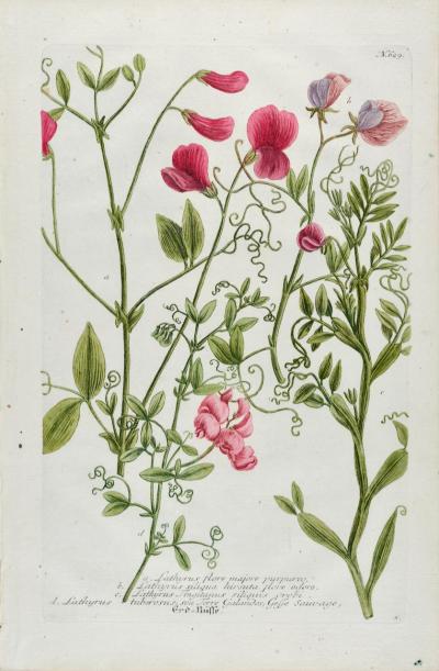
Red Sweet Pea: An 18th Century Hand-colored Botanical Engraving by J. Weinmann
-
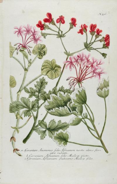
Red Geranium: An 18th Century Hand-colored Botanical Engraving by J. Weinmann
-
Burning Bush: An 18th Century Hand-colored Botanical Engraving by J. Weinmann
-
American Coot: An Original 19th C. Audubon Hand-colored Bird Lithograph

-
Butterflies & Moths: An Antique Hand-colored Engraving by Moses Harris

-
Butterflies & Moths: A 1st Ed. Hand-colored 18th C. Engraving by M. Harris

-
Apple: An 18th Century Hand-colored Botanical Engraving by J. Weinmann

-
Natural History of Moths and a Beetle: A Hand-colored Engraving by Moses Harris

-
American Avocet: An 19th Century Audubon Hand-colored Bird Lithograph

-
Asparagus: An 18th Century Hand-colored Botanical Engraving by J. Weinmann

-
Admirable Butterflies, Magpie Moths: A Hand-colored Engraving by Moses Harris

-
Peacock Butterfly & Moth: A 1st Ed. Hand-colored 18th C. Engraving by M. Harris

-
Cotton Plant: An 18th Century Hand-colored Botanical Engraving by J. Weinmann

