
Offered by:
The Great Republic
1 Lake Circle
Colorado Springs, CO 80906 , United States
Call Seller
719.471.6157
Showrooms
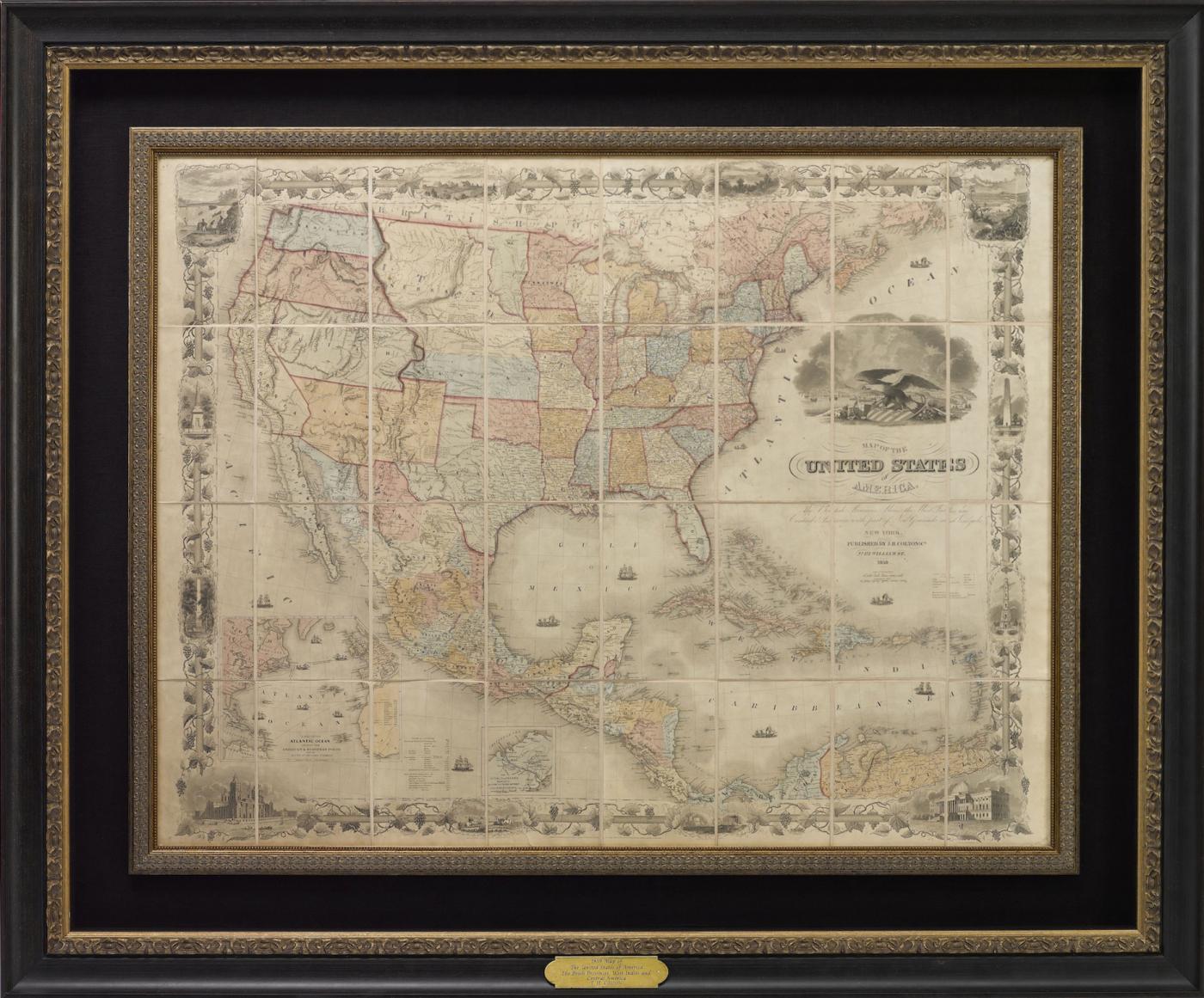
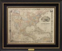
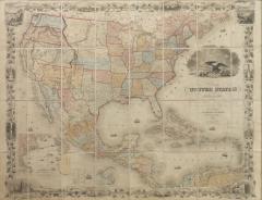
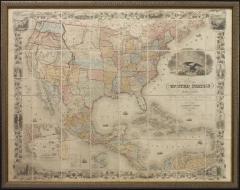
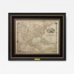
1859 "Map of the United States of America, British Provinces, Mexico" by Colton
-
Description
Presented is an 1859 “Map of the United States of America, the British Provinces, Mexico, the West Indies and Central America with Part of New Granada and Venezuela” by John Hutchinson Colton. First published in 1848, this map was updated in 1859 and shows the progress of the years since its earlier issues. The large hand-colored engraved case map depicts the United States in the mid-19th century, before the Civil War.
The map has an elaborate and decorative pictorial border, with scenes of the “US Capitol,” “Entrance of a Port,” “Mexicans Catching Wild Cattle,” “Cathedral City of Mexico,” “Willamette Falls, Oregon,” “Astoria, Oregon,” “Saratoga Lake, New York”, “Valley of the Connecticut,” as well as four monuments, inset into the border. The intertwined grapevine border is dotted with scenes of fishing, farming, and beautiful vistas across the top of the map. The bottom vignettes show ranching and shipping.
A dramatic, emblematic title vignette features an American bald eagle, atop a patriotic shield. With an olive branch in one talon and arrows in the other, the eagle is flanked on its left by a cornucopia overflowing with fruits and vegetables. Farming equipment is engraved behind. On its right are tools of navigation, exploration, shipping, and trade. The background is a large port city connected by steam railroad and steam-powered paddleboat, highlighting the many possibilities for interior trade along railways, canals, and rivers.
Emphasizing the commercial prosperity of the Americas, there are several ships shown on the waterways. Additionally, there appears a “Table of Distances” to major ports in North America, as well as across the Caribbean and South America. A large inset map on the lower left shows the Atlantic Ocean and its bordering continents, serving to illustrate the booming transatlantic commerce.
This map was published in 1859; after the Mexican-American War and during the height of gold prospecting and mining in the west and the influx of new settlers. Texas’ borders are updated to reflect both the Adams-Onís Treaty of 1819 and the Compromise of 1850. Roads between major cities, as well as exploration and travel routes, crisscross the state. Captain Randolph Marcy’s 1849 route from Arkansas to New Mexico then back across Texas appears on the map, as well as the Comanche Trail south into the Mexican State of Coahuila. The southern borders of Arizona and New Mexico reflect the recent Gadsden Purchase. The map also includes the Washington Territory, Kansas Territory, and the new state of Minnesota. The map was updated from Colton's earlier editions to reflect the best available information from the western portion of the country.
The Colton family led the market in the American map trade during the nineteenth century. The business was founded by Joseph Hutchins Colton (1800-1893). By the 1850's, their output expanded to include original maps, guidebooks, atlases, and railroad maps. Joseph was succeeded by his sons, George Woolworth (1827-1901) and Charles B. Colton (1831-1916), at which time the firm was renamed G. W. & C. B. Colton.
CONDITION:
Map in good condition. Map is dissected into its 32 segments and mounted to linen, with silk selvage and original marbled self-wrappers. A lithographed date label pasted below imprint. Small repairs were made by the previous owner. The map retains a nice aged patina. Map Dimensions: 35” H x 45” W .
Map has been archivally framed in a custom-built black and gold frame, with golden spandrels, UV plexiglas, and a custom plaque. -
More Information
Documentation: Documented elsewhere (exact item) Notes: Printed maker's name Origin: United States Period: 19th Century Materials: Lithograph Condition: Good. Small repairs were made by the previous owner. The map retains a nice aged patina. Creation Date: 1859 Styles / Movements: Americana, Traditional Dealer Reference #: M295 Incollect Reference #: 700277 -
Dimensions
W. 59 in; H. 49 in; Diam. 4.25 in; W. 149.86 cm; H. 124.46 cm; Diam. 10.8 cm;
More Listings from The Great Republic View all 38 listings
-
"Colorado" Vintage United Airlines Travel Poster by Joseph Feher, 1950s

-
Civil War-Era Side Drum, Made by George Kilbourn, 1859

-
The White House Cookbook by F. L. Gillette, Later Printing, 1894

-
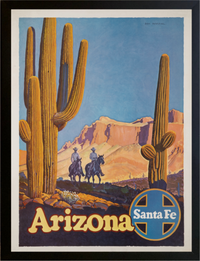
"Arizona" Vintage Santa Fe Railroad Travel Poster by Don Perceval, circa 1940s
-
From Russia, With Love by Ian Fleming, First Edition, 1957

-
34-Star Civil War Kansas Flag Great Star “Flower” Pattern, Circa 1861

-
Vintage Union Jack, Circa 1950s

-
"Come to Britain for Golf" Vintage Travel Poster, Circa 1952

-
"Fort Worth" Vintage Delta Airlines Travel Poster by John Hardy, circa 1950s

-
The Catcher in the Rye by J.D. Salinger, First Edition, in Dust Jacket, 1951

-
George Washington Signature Collage

-
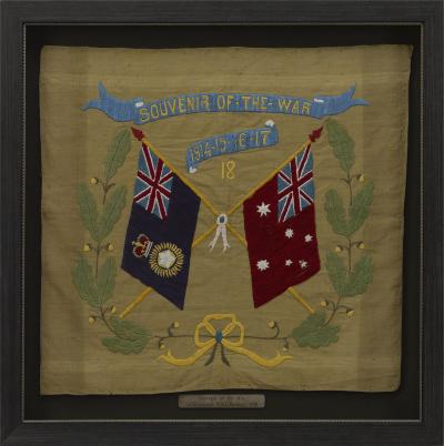
Souvenir of the War 1914-15-16-17-18 Banner
-
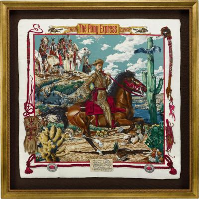
Vintage "The Pony Express" Hermès Scarf by Kermit Oliver
-
Through the Looking-Glass and What Alice Found There, Lewis Carroll, 1st US Ed.