


Offered by:
Arader Galleries
1016 Madison Avenue
New York City, NY 10075 , United States
Call Seller
215.735.8811
Showrooms
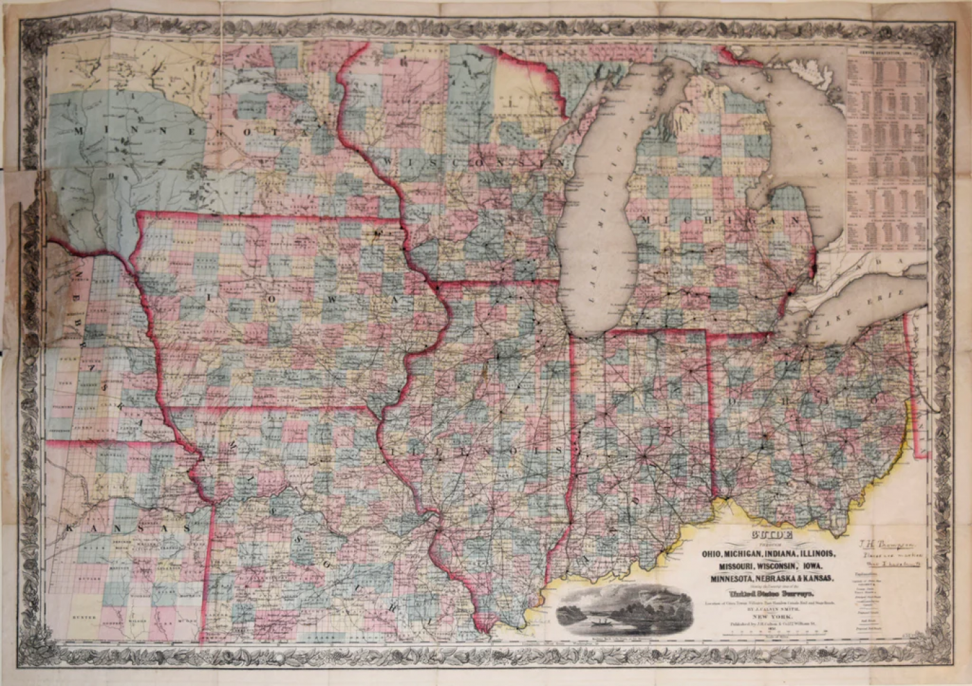
GUIDE THROUGH OHIO, MICHIGAN, INDIANA, ILLINOIS, MISSOURI, WISCONSIN
-
Description
Joseph Hutchins Colton (American, 1800-1893)
Guide through Ohio, Michigan, Indiana, Illinois, Missouri, Wisconsin, Iowa, Minnesota, Nebraska and Kansas…
Surveyed by J. Calvin Smith
Published, J.H. Colton, New York, 1857
Steel engraving with original hand-coloring and original boards
Manuscript notation lower right in ink, “J. H. Thompson, Places are market that I have been to”
Paper size 21 x 28 ½”
Image size 20 x 27 ?” -
More Information
Documentation: Documented elsewhere (similar item) Period: 19th Century Condition: Good. Styles / Movements: Traditional Incollect Reference #: 639188
Message from Seller:
Founded in 1971, Arader Galleries is the leading dealer of rare maps, prints, books, and watercolors from the 16th to 19th centuries. Visit us at 1016 Madison Avenue, NYC, or contact us at 215.735.8811 | loricohen@aradergalleries.com |
More Listings from Arader Galleries View all 1340 listings
-
PHILADELPHIA SIDE CHAIR (INV. 0033)

-
ENGLISH NEOCLASSICAL SIDE CHAIR (INV. 0026)
-
DROP-LEAF OR DINING TABLE, NEWPORT, RHODE ISLAND, 1780-95 (INV. 0348)

-
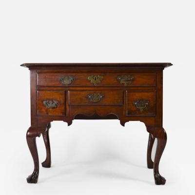
PHILADELPHIA DRESSING TABLE (INV. 0327)

-
UNTITLED [UNIFINISHED YELLOW BIRD]

-
PAIR OF SIDE CHAIRS (INV. 0303)

-
DELAWARE VALLEY DRESSING TABLE (INV. 0331)
-
VERY FINE AND RARE CHIPPENDALE CARVED AND FIGURED MAHOGANY DESK-AND-BOOKCASE
-
PHILADELPHIA RACKET-BACK SIDE CHAIR (INV. 0023)

-
PHILADELPHIA DRESSING TABLE (INV. 0338)
-
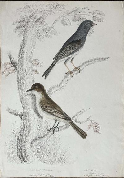
THE PEOWIT FLYCATCHER APRIL 4 1836 MUSCICAPA NUNCIOLA WILS./
-
NORTHERN DELAWARE OR SOUTHEASTERN PENNSYLVANIA HIGH CHEST OF DRAWERS
-
NEW YORK MARLBOROUGH LEG SIDE CHAIR (INV. 0017)

-
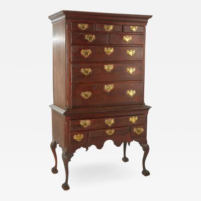
PENNSYLVANIA WALNUT TALL CHEST ON FRAME (Inv. 320)

