


Showrooms
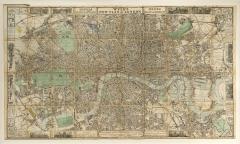
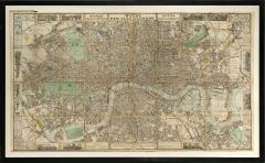
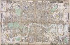
Wyld's New Plan of London.
-
Description
WYLD, James
Wyld's New Plan of London.
London, James Wyld, 1871.
Folding coloured linen-backed map - extends from Homerton - Blackheath; Holland Park - Canning Town; a very attractive map. Map dimensions: 55 x 96 cm
A scarce edition not recorded in the standard bibliographies. Includes many of the now very wealthy ‘villages’ of London.
Framed and glazed, overall dimensions: 65cm by 105cm by 3.5cm. -
More Information
Documentation: Ample Provenance Origin: England Period: 19th Century Materials: Hand-coloured engraving on paper laid on linen Condition: Fair. Creation Date: 1871 Styles / Movements: Traditional Book References: Not located in Hyde or Boyle. Dealer Reference #: 105134 Incollect Reference #: 510453 -
Dimensions
W. 105 in; H. 65 in; D. 3.5 in; W. 266.7 cm; H. 165.1 cm; D. 8.89 cm;
Message from Seller:
Shapero Gallery Located in the heart of Mayfair, London, Shapero Gallery specializes in prints and original works on paper, ranging from antique prints to modern pochoir plates and photography. For inquiries, contact us at +44.207.493.0876 or gallery@shapero.com.
Sold
More Listings from Shapero Gallery View all 646 listings
-
Frozen Hearts
-
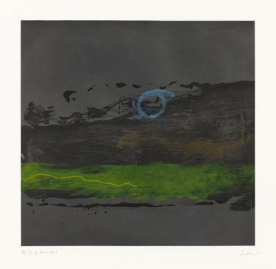
Contentment Island By Helen FRANKENTHALER

-
A New Map of England and Wales. by J & C WALKER

-
The Antarctic Manual
-
Narcissus

-
Pancratium Calathiforme

-
Mergus Serrator [Merganser]

-
A Pair of Melons

-
The Tale of the Faithful Dove. by BEATRIX POTTER
-
Giovannoli, Four Groups of Nine Grotesque Masks, 1781

-
Broome Street at Night By Helen FRANKENTHALER
-
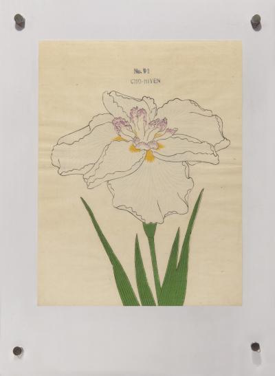
Japanese Iris - CHO-HIYEN
-
Set of Four Vases by Giovanni Battistia Piranesi

-
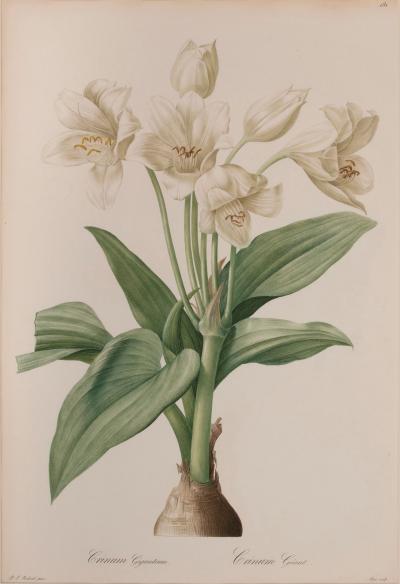
Crinium Giganteum