


Showrooms
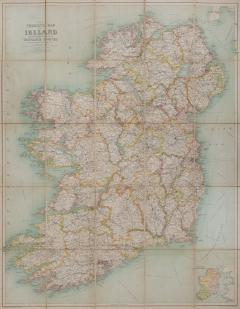
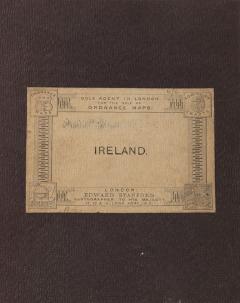
The Tourist's Map of Ireland by JOHN BARTHOLOMEW
-
Description
BARTHOLOMEW, JOHN.
The Tourist's Map of Ireland
reduced by permission from the Ordnance Survey by John Bartholomew F.R.G.S.
Stock Code 107841
London, Edward Stanford, 1896
£125
A lovely example of this folding map of Ireland, depicting the counties of Ireland pre-partition.
Lithograph map, printed in colours, dissected into 25 folding sections and mounted on linen, (size: 76.2 x 60.7 cm), yellow publisher's advertisements at endpapers, folding into original plum boards with buff publisher's label; a very good example. - More Information
- Dimensions
Message from Seller:
Shapero Gallery Located in the heart of Mayfair, London, Shapero Gallery specializes in prints and original works on paper, ranging from antique prints to modern pochoir plates and photography. For inquiries, contact us at +44.207.493.0876 or gallery@shapero.com.
Sold
More Listings from Shapero Gallery View all 646 listings
-
Giovannoli, Four Groups of Nine Grotesque Masks, 1781

-
Narcissus

-
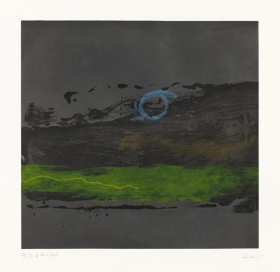
Broome Street at Night By Helen FRANKENTHALER
-
A Pair of Melons

-
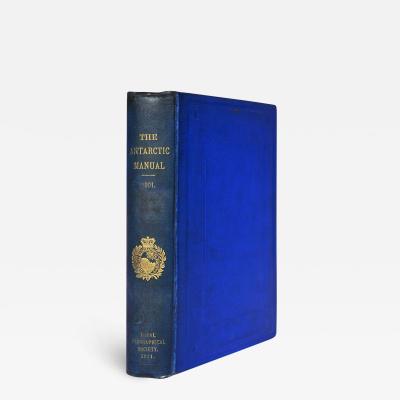
The Antarctic Manual
-
Set of Four Vases by Giovanni Battistia Piranesi

-
Contentment Island By Helen FRANKENTHALER

-
A New Map of England and Wales. by J & C WALKER

-
A Monograph of the Trogonidae, or Family of Trogons. by John GOULD

-
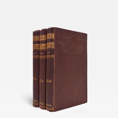
Frozen Hearts
-
Japanese Iris - CHO-HIYEN

-
The Tale of the Faithful Dove. by BEATRIX POTTER

-
Mergus Serrator [Merganser]

-
Pancratium Calathiforme


