


Offered by:
The Great Republic
1 Lake Circle
Colorado Springs, CO 80906 , United States
Call Seller
719.471.6157
Showrooms
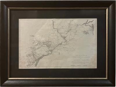
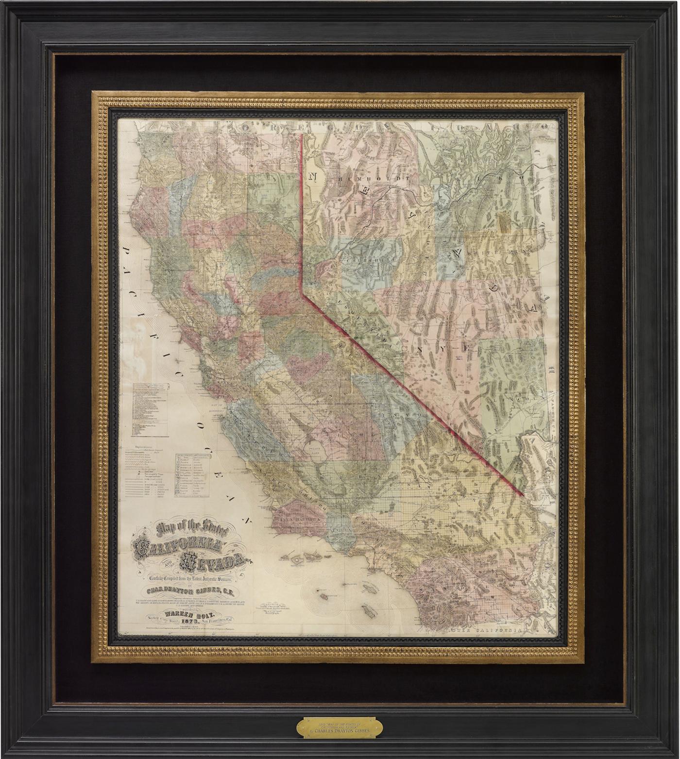
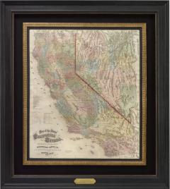
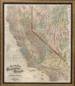
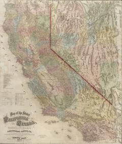
1873 "Map of the States of California and Nevada" by Charles Drayton Gibbes
-
Description
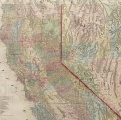
Presented is Warren Holt and Charles Drayton Gibbes' 1873 “Map of California and Nevada.” This map is considered to be one of the finest large-scale maps of California to appear in the second half of the 19th century. Depicting all of California and Nevada, the map offers exceptional detail throughout. To the left, a key identifies 14 federal land districts, 20 California judicial districts, and 9 Nevada counties.
The region’s complex topography is indicated by hachuring, and roads, trails, and rail lines are identified. Included is the route of the Central Pacific Railroad, construction of which began in 1863. There is an abundance of information about towns, settlements, ranches, and mineral resources, and dozens of mining districts are delineated and named.
This map is one of the best and most detailed maps of the region, praised for its detail, accuracy, and compilation of the most recent information, as discovered by explorations of Henry de Groot, Williamson, land and railroad surveys, and border changes issued by the General Land Office administration. Charles Gibbes first issued his large format map of California and Nevada in 1869. He then updated and published the map in a smaller size in 1873, presented here in its rare second state. A third edition was published in 1878.
CONDITION:
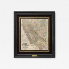
Very good. Map trimmed to the neat line, apparently by the publisher. Professionally flattened and backed on linen. Repaired slight loss along some of the original fold lines. Map has been framed in a custom-built archival black and gold wooden frame with acid-free mats, golden spandrel, UV Plexiglas, and a custom plaque. - More Information
- Dimensions
Message from Seller:
Established in 2010, The Great Republic specializes in one-of-a-kind collectibles that honor American history, with a special focus on the rare and unique. Our collection is complete with rarities that are sure to wow, such as first edition books, antique hand-sewn flags from the Civil War, vintage travel posters, and original signatures from American presidents, such as George Washington and Abraham Lincoln, just to name a few. P: 719.471.6157 E: headquarters@great-republic.com