


Offered by:
The Great Republic
1 Lake Circle
Colorado Springs, CO 80906 , United States
Call Seller
719.471.6157
Showrooms
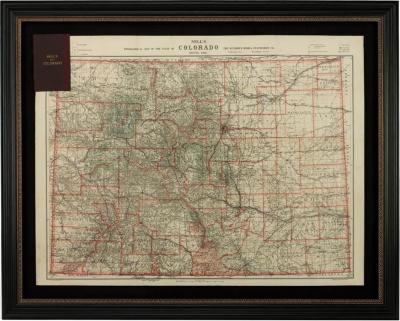
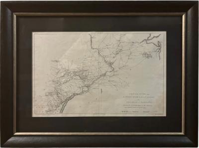
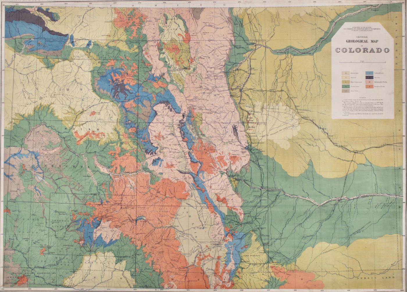
1877 "General Geological Map of Colorado" by F.V. Hayden
-
Description
Offered is an original “General Geological Map of Colorado” by F. V. Hayden. The map was printed as part of the 1877 “Geological and Geographical Atlas of Colorado and Portions of Adjacent Territory,” lithographed by Julies Bein, and sponsored by the U.S. Department of the Interior. The maps from the “Atlas of Colorado” were produced based on extensive field work completed between 1873 to 1876, covering the state of Colorado, as well as portions of Utah, Arizona and New Mexico. This particular map shows Colorado, color coded by geological time periods. A key at top right references the geological makeup of the area, with Quaternary, Tertiary, Post Cretaceous, Cretaceous, Jura-Trias, Carboniferous, Silurian, Metamorphic Rocks, and Eruptive Rocks identified in vibrant colors. Cities, towns, railroads, rivers, and mountains are also identified in black.
In 1867, the government-funded, systematic surveying and mapping of Western geology and geography began in earnest. Scientists, geologists, and military engineers organized a group of experts to travel through the West, mapping and cataloging the land and its resources. Between 1867 and 1879, Congress authorized and funded four significant surveys, under four leaders: the Powell Survey, under John Wesley Powell (1870–78); the King Survey, led by Clarence King (1867–78); the Wheeler Survey, under Lieutenant George M. Wheeler (1871–79); and the Hayden Survey, led by Ferdinand Vandeveer Hayden (1867–79). The four surveys consolidated into the United States Geological Survey (USGS).
The Hayden Survey was the largest and best funded of the four major surveys. Hayden wrote that he felt a comprehensive survey of Colorado would “yield more useful results, both of a practical and scientific character. . . . The prospect of its [Colorado’s] rapid development within the next five years, by some of the most important railroads of the West, renders it very desirable that its resources be made known to the world at as early a date as possible” (Hayden 1874, 11).
The area of Colorado of most interest to Hayden was the mountains and western plateaus of the territory. His survey looked at the prairie-mountain interface, but did not venture very far eastward into the plains. Hayden felt that the plains’ geology was not of much interest in either a resource or scientific sense, due to its relatively simple geology, few mineralogical resources, and limited use beyond farming and ranching.
The Atlas required the concerted efforts of all Hayden field parties for several years. Hayden’s method of operation was to create nearly-independent survey teams or divisions, which would work in separate locations throughout the field season. Each survey division consisted of a topographer or cartographic and surveying expert, one or two geologists, one or more natural scientists (i.e. a paleontologist, botanist, or zoologist), and enough support men to run the camp and care for the mules. Three or four of these divisions were used each year. Each team was responsible for areas of 5,000 square miles or more. The fourth team was headed by Hayden himself.
This meticulous survey was the only one of a single state or territory ever completed in such depth. Hayden’s scientific research made Colorado the most intensively studied place in the entire West, with the possible exception of California. His surveys and the resulting data output created an unparalleled number of publications , the most significant being the Atlas of Colorado.
CONDITION:
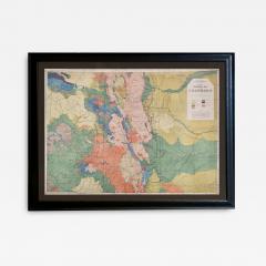
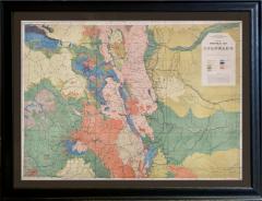
Original color lithograph. Color is strong and vibrant. Paper has light toning and some creases along outer margins. Paper is healthy, without tears, and full margins. Map is linen backed in royal blue.
Map has been artfully and archivally framed with a dark grey acid-free top mat, UV Plexiglas, and a custom-built black wooden frame. - More Information
- Dimensions
Message from Seller:
Established in 2010, The Great Republic specializes in one-of-a-kind collectibles that honor American history, with a special focus on the rare and unique. Our collection is complete with rarities that are sure to wow, such as first edition books, antique hand-sewn flags from the Civil War, vintage travel posters, and original signatures from American presidents, such as George Washington and Abraham Lincoln, just to name a few. P: 719.471.6157 E: headquarters@great-republic.com
Sold