


Offered by:
The Great Republic
1 Lake Circle
Colorado Springs, CO 80906 , United States
Call Seller
719.471.6157
Showrooms
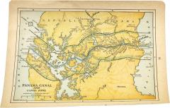
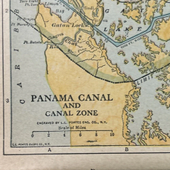
1936 "Panama Canal and Canal Zone" Map, Engraved by L.L. Poates
-
Description
Presented is an attractive, engraved map of the “Panama Canal and Canal Zone.” The map was engraved by L.L. Poates, for inclusion in the 1936 printing of “The Popular Atlas of the World.” The atlas was published by The World Syndicate Publishing Company. A small map, with original printed color, it details the entire course of the Panama canal, from Limon Bay to Panama City. The map locates canal locks, canal depths and widths, and the Panama railroad. Special attention is paid to the area's intricate system of rivers and waterways that feed the canal. A dotted line also delineates the border between the Republic of Panama and the Panama Canal Zone.
The Panama Canal is an manmade waterway in Panama that connects the Caribbean Sea with the Pacific Ocean. It cuts across the narrowest point of the Isthmus of Panama, and is a conduit for maritime trade between the Atlantic and Pacific Oceans. Bridging the Isthmus of Panama had been conceived of long before the completion of the Panama canal, yet was delayed by formidable geographical and natural hurdles, including dense jungle, mountains, and tropical diseases, as well as geopolitical and funding issues. The first major link across the isthmus was the Panama Railroad, built by American investors in the early 1850s during the California Gold Rush. French diplomat Ferdinand de Lesseps made the first attempt to build a canal in the area. Lesseps had successfully excavated the Suez Canal and saw the construction of the Panama Canal as his grand and lucrative next project. He incorporated the Compagnie Universelle du Canal Interoceanique on March 3, 1881, which purchased a controlling stake in the existing railroad. Unprepared for the formidable terrain and jungle climate, his progress was mired by disease, poor planning, political posturing, and funding issues. The Compagnie Universelle du Canal Interoceanique was dissolved by a French bankruptcy court on February 4, 1889 in a large political scandal.
Five years later, in 1894, the company's assets were reorganized under new investors, as Compagnie Nouvelle du Canal de Panama. This organization began plans to resume excavations and produced several detailed new maps of the project. Eventually, the French lost control of the canal project to the United States. In 1903, the Hay-Bunau-Varilla Treaty between the United States and Panama granted the U.S. canal-building rights and the sole right to operate and control the Canal Zone. The Compagnie Nouvelle du Canal de Panama sold its holdings, including the railroad, to the United States in 1904, supplanting an earlier failed American venture to build a canal in Nicaragua. The Panama Canal officially opened under U.S. management 10 years later in 1914.
The Panama Canal was an engineering marvel several decades in the making. It drastically cut travel times between the Pacific and Atlantic Oceans, was a major asset to the Allies during World War II, and helped Panama to become the wealthiest country in Central America on a per capita basis. The Canal Zone remained a U.S. territory until the 1977 Torrijos-Carter Treaty began a gradual return of the territory to Panamanian sovereignty and management. After coming under full Panamanian control in 2000, a third and wider lane of locks was constructed and opened in 2016, allowing larger container ships to transit the Canal.
Leonard L. Poates was an American engraver and publisher who started his own company, the L. L. Poates Engraving Company, in New York City around 1910. In addition to his own popular “Handy Atlas,” “Complete Atlas of the World,” “Highway and Regional Guide of the United States,” and “Radio Map of the United States and Canada,” Poates and his company worked on maps for other publishing companies’ atlases, including those issued by P. F. Colliers and Son and Dodd, Mead & Co.
CONDITION:
Good condition overall. Engraved map, with original printed color. Color is attractive, with little fading. Compass rose in the upper left corner, scale of miles in lower left corner. “Page 86” printed along the right side margin. Paper is healthy, with only several small binding holes in outer bottom margins, from previous inclusion in atlas. Map is sold unframed, as-is.
Unframed Dimensions: 5 9/16" H x 7 3/4" W.
Accompanied by our company's letter of authenticity. -
More Information
Documentation: Certificate of Authenticity Period: 1920-1949 Condition: Good. Styles / Movements: Modern Incollect Reference #: 800254 -
Dimensions
W. 7.75 in; H. 5.625 in; W. 19.69 cm; H. 14.29 cm;
Message from Seller:
Established in 2010, The Great Republic specializes in one-of-a-kind collectibles that honor American history, with a special focus on the rare and unique. Our collection is complete with rarities that are sure to wow, such as first edition books, antique hand-sewn flags from the Civil War, vintage travel posters, and original signatures from American presidents, such as George Washington and Abraham Lincoln, just to name a few. P: 719.471.6157 E: headquarters@great-republic.com
More Listings from The Great Republic View all 292 listings
-
A Good-Natured Map of the United States
-
Map of the United States, with its Territories; also Mexico and the West Indies
-
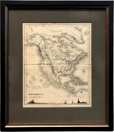
1846 "North America" Map, Engraved by I. Dower
-
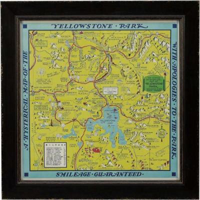
A Hysterical Map of Yellowstone National Park by Jolly Lindgren, 2nd Ed Printing
-
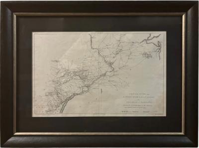
"A Map of the Country from Rariton River in East Jersey to Elk Head in Maryland"
-
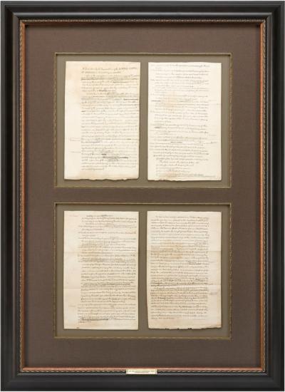
1829 "Declaration of Independence" Draft, Engraved by Charles Toppan
-
Victory Through Air Power By Major Alexander P. De Seversky

-
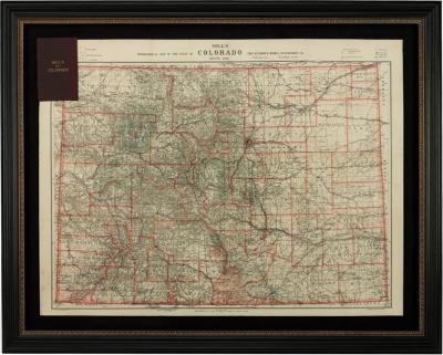
1904 "Nell's Topographical Map of the State of Colorado"
-
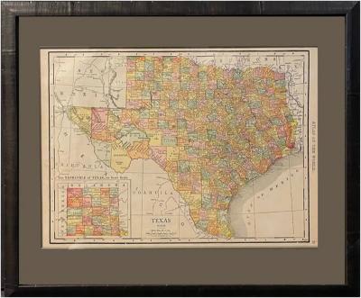
1912 "Texas" Map by Rand McNally & Co.
-
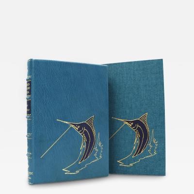
The Old Man and the Sea by Ernest Hemingway, First Edition, 1952
-
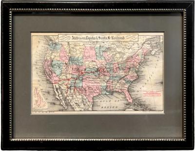
"General Map of the United States Showing the Lines of the Atchison
-
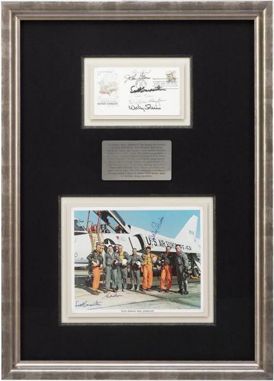
Mercury Seven Signature Collage
-
Wrath in Burma by Fred Eldridge, First Edition, In Original Dust Jacket, 1946

-
"Atlas to Accompany Monograph XXXII on the Geology of Yellowstone National Park"