


Offered by:
Arader Galleries
1016 Madison Avenue
New York City, NY 10075 , United States
Call Seller
215.735.8811
Showrooms
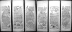
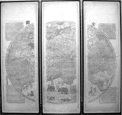
FERDINAND VERBIEST (1623-1688), [WORLD MAP] KUN-YU CH'UAN-TU.
-
Description
Ferdinand Verbiest (1623-1688)
[World Map] Kun-Yu Ch'uan-Tu.
Engraved twelve sheet map with vertical sections joined to form six sheets.
Korea, Seoul, c. 1860.
6' 2" x 11' 6" overall.
Sino-Centric map showing China as the center of the Universe.
Flemish scientist Ferdinand Verbiest joined the Jesuit order in 1641; he traveled to Macao in 1659, where he studied Chinese and Confucian classics and took his final religious vows. He was a polymath best known for this Chinese world map, a revised Chinese calendar, and astronomical works in Chinese and Latin. Notwithstanding his status as a foreigner he developed an unusually close relationship with the Kangxi emperor, who conferred mandarin rank on Verbiest and granted him an official funeral. For the emperor, cartography was a significant expression of his control over the regions under imperial domain. Verbiest's world map drew from contemporary Dutch maps and Chinese sources, but it presented the world in a format appropriate to a Chinese audience. Counter to Western mapmaking traditions that focused on Europe, the Kunyu quantu deferred to local conventions by placing China at the symbolic center, surrounded by countries that could be construed as tributary states" (Getty Museum online). In 1647 Ferdinand Verbiest produced one of the largest double hemisphere maps of the world to date. It was made for the second Qing Emperor of China, K'ang-hsi (1662-1722) and was part of a larger geographical work called K'un-yü t'u-shuo [Illustrated Discussion of the Geography of the World]. Approximately eight copies survive of the original map. Verbiest's unique map was primarily made for Chinese use and designed to open China's eyes to the rest of the world. It incorporates Chinese text with European cartographic knowledge of the globe at that time. In keeping with Chinese tastes and their belief that Peking was the cultural and political center of the world, China is placed at the center of the map with the rest of the world flanking it. The map is drawn using Mercator's projection. Descriptive cartouches explain geographic details and peculiarities of countries and oceans, as well as describing natural phenomena such as eclipses and earthquakes. Columbus' discovery of America is also discussed. The likely source for Verbiest's map was Joan Blaeu's monumental world map of 1648, Nova totius terrarum orbis tabula. Although the delineation of China differs, the maps are similar in size and a comparison and a concordance of geographical names shows clearly the relationship between the two maps. In total twenty-three different animals, believed to be unknown or little-known in China, decorate the margins. The illustrations were derived from Konrad Gessner's Historia animalium (1551) and this part of the map became most influential - the illustrations and their descriptions were copied into the imperial encyclopedia T'u-shu chi-ch'eng of 1723 and the transliterated names included in Chinese and Manchu dictionaries. -
More Information
Documentation: Documented elsewhere (similar item) Period: Pre 18th Century Styles / Movements: Traditional Incollect Reference #: 599345 -
Dimensions
W. 138 in; H. 74 in; W. 350.52 cm; H. 187.96 cm;
Message from Seller:
Founded in 1971, Arader Galleries is the leading dealer of rare maps, prints, books, and watercolors from the 16th to 19th centuries. Visit us at 1016 Madison Avenue, NYC, or contact us at 215.735.8811 | loricohen@aradergalleries.com |
More Listings from Arader Galleries View all 1350 listings
-
NEW YORK MARLBOROUGH LEG SIDE CHAIR (INV. 0017)

-
PENNSYLVANIA WALNUT TALL CHEST ON FRAME (Inv. 320)

-
PHILADELPHIA CARD TABLE (INV. 0301)
-
NEW YORK CHIPPENDALE SIDE CHAIR (INV. 0010)
-
JEAN LOUIS PREVOST (1760-1810), PLATE 20

-
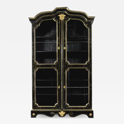
A LOUIS XIV ORMOLU-MOUNTED AND BRASS-INLAID EBONIZED BOOKCASE
-
DROP-LEAF OR DINING TABLE, NEWPORT, RHODE ISLAND, 1780-95 (INV. 0348)

-
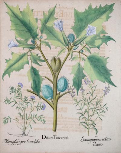
BASILIUS BESLER (1561-1629), DATURA TURCARUM
-
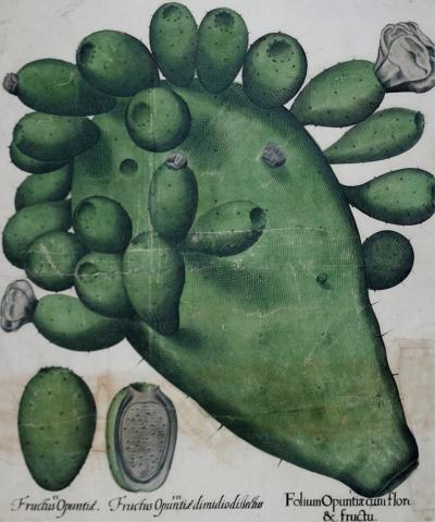
BASILIUS BESLER (1561-1629), FOLIUM OPUNTIACUM FLORE & FRUCTU
-
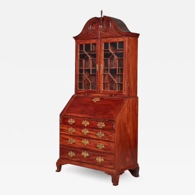
VERY FINE AND RARE CHIPPENDALE CARVED AND FIGURED MAHOGANY DESK-AND-BOOKCASE
-
DELAWARE VALLEY, 1760-90, DROP-LEAF OR DINING TABLE (INV. 0355)

-
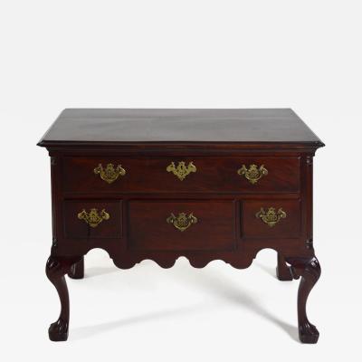
DELAWARE VALLEY DRESSING TABLE (INV. 0331)
-
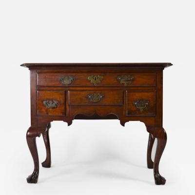
PHILADELPHIA DRESSING TABLE (INV. 0338)
-
PHILADELPHIA RACKET-BACK SIDE CHAIR (INV. 0023)

